Para aprender más: los puntos cardinales
ProfeCoins 5
Downloads count 4
Resource type Worksheet
Recommended age 7 - 8 years
File information pdf, 1 pages, 418 KB
Download
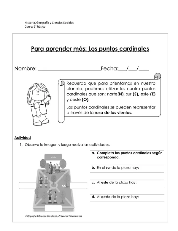
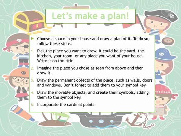
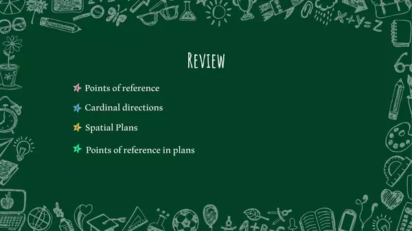
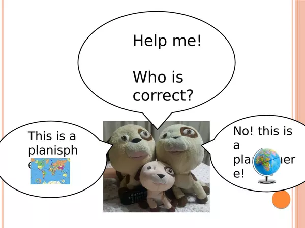
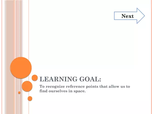
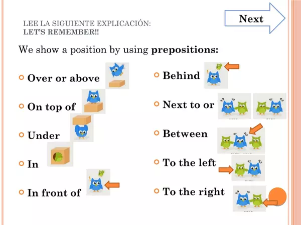
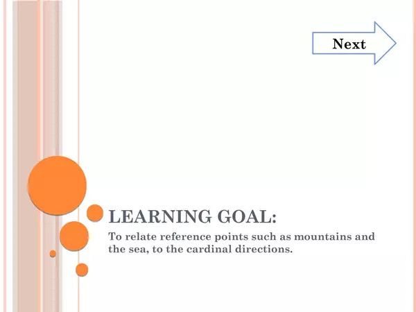
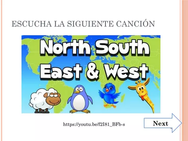
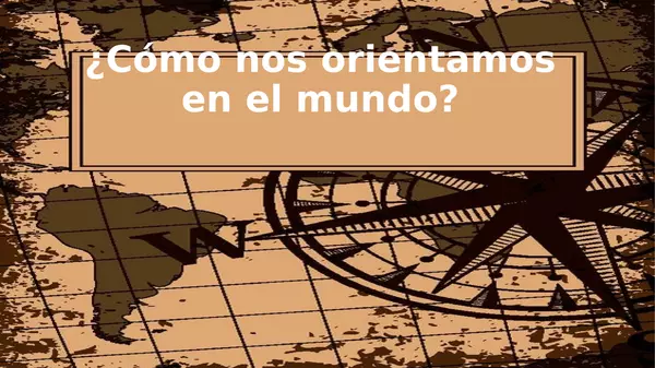
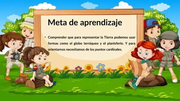
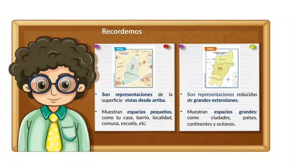
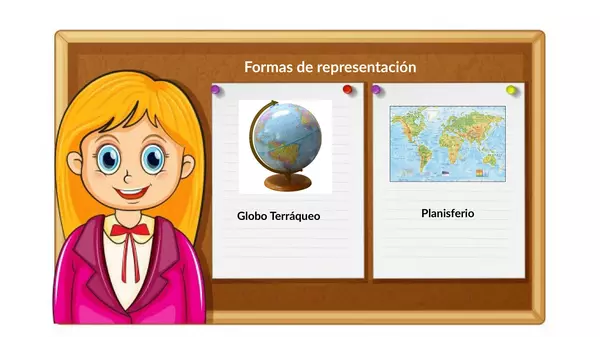
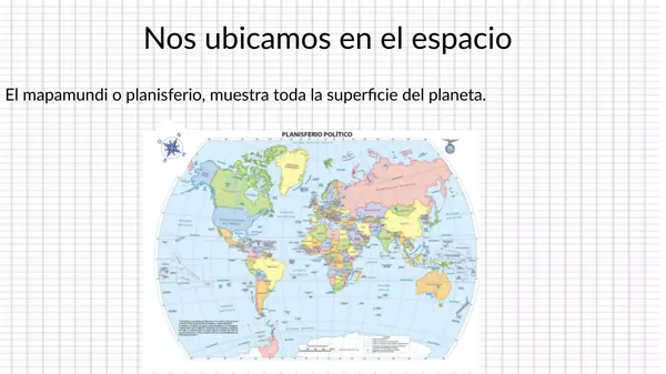
Esta guía tiene como objetivo que los estudiantes puedan aplicar sus saberes en relación a los puntos cardinales, asociándolos a referentes locales como la cordillera, mar u otro. 

There are no comments yet, write one yourself!

Spatial Plans Spatial Plans Spatial Plans Spatial Plans Spatial Plans
ProfeCoins 5
Resource type Lesson
Recommended age 7 - 8 years
File information pptx, 23 pages, 2.72 MB
Download
You can use this interactive PowerPoint either for distance learning or for face-to-face ones, especially if you've got a smartboard.
Some of the instructions are in Spanish, as some adults at home may have a hard time with English.
This PowerPoint is the third of the series "How can we use spatial representations?"

Learning Goal:
To understand plans and their symbols.

See the other PowerPoints of the series here:
  1. Points of reference
  2. Cardinal directions
  3. Spatial Plans (This resource)
  4. Points of reference in plans
  5. How can we use spatial representations? Review
This resource greatly works with the book: 2 primary Social Sciences - Savia

There are no comments yet, write one yourself!

Points of reference in plans Points of reference in plans Points of reference in plans Points of reference in plans
ProfeCoins 5
Resource type Lesson
Recommended age 7 - 8 years
File information pptx, 8 pages, 4.54 MB
Download
You can use this PowerPoint either for distance learning or for face-to-face ones, as this activity may be edited for different contexts.
Some of the instructions are in Spanish, as some adults at home may have a hard time with English.
This PowerPoint is the fourth of the series "How can we use spatial representations?"

Learning Goal:
To interpret a map using reference points and cardinal directions.

See the other PowerPoints of the series here:
  1. Points of reference
  2. Cardinal directions
  3. Spatial Plans
  4. Points of reference in plans (This resource)
  5. How can we use spatial representations? Review
This resource greatly works with the book: 2 primary Social Sciences - Savia 

There are no comments yet, write one yourself!

How can we use spatial representations? Review How can we use spatial representations? Review How can we use spatial representations? Review How can we use spatial representations? Review How can we use spatial representations? Review
ProfeCoins 5
Resource type Lesson
Recommended age 7 - 8 years
File information pptx, 14 pages, 7.62 MB
Download
You can use this PowerPoint either for distance learning or for face-to-face one.
This is a review of How can we use spatial representations.

Learning Goal: To evaluate progress made learning the topics studied in the lesson.

It includes:
  • Points of reference
  • Cardinal directions
  • Spatial plans
  • Points of reference in plans
Some of the instructions are in Spanish, as some adults at home may have a hard time with English.
This PowerPoint is the fifth of the series "How can we use spatial representations?"

See the other PowerPoints of the series here:
  1. Points of reference
  2. Cardinal directions
  3. Spatial Plans
  4. Points of reference in plans
  5. How can we use spatial representations? Review (This resource)
This resource greatly works with the book: 2 primary Social Sciences - Savia

There are no comments yet, write one yourself!

Where is Chile located? Where is Chile located? Where is Chile located? Where is Chile located? Where is Chile located?
ProfeCoins 5
Downloads count 1
Resource type Lesson
Recommended age 7 - 8 years
File information pptx, 17 pages, 2.08 MB
Download
You can use this interactive PowerPoint either for distance learning or for face-to-face ones, especially if you've got a smartboard.
Some of the instructions are in Spanish, as some adults at home may have a hard time with English.

Learning Goal: To locate Chilean territory on a world map and a globe.

This PowerPoint is the sixth of the series "How can we use spatial representations?"

See the other PowerPoints of the series here:
  1. Points of reference
  2. Cardinal directions
  3. Spatial Plans
  4. Points of reference in plans
  5. How can we use spatial representations? Review
  6. Where is Chile located (This resource)
This resource greatly works with the book: 2 primary Social Sciences - Savia

There are no comments yet, write one yourself!

Points of reference Points of reference Points of reference Points of reference Points of reference
ProfeCoins 5
Resource type Lesson
Recommended age 7 - 8 years
File information pptx, 16 pages, 1.7 MB
Download
You can use this interactive PowerPoint either for distance learning or for face-to-face ones, especially if you've got a smartboard.
Some of the instructions are in Spanish, as some adults at home may have a hard time with English.

Learning Goal: To recognize reference points that allow us to find ourselves in space.
 
This PowerPoint is the first of the series "How can we use spatial representations?"

Hope you like it!

See the other PowerPoints of the series here:
  1. Points of reference (this resource)
  2. Cardinal directions
  3. Spatial Plans
  4. Points of reference in plans
  5. How can we use spatial representations? Review
This resource greatly works with the book: 2 primary Social Sciences - Savia

There are no comments yet, write one yourself!

Cardinal directions Cardinal directions Cardinal directions Cardinal directions Cardinal directions
ProfeCoins 5
Resource type Lesson
Recommended age 7 - 8 years
File information pptx, 19 pages, 1.83 MB
Download
You can use this interactive PowerPoint either for distance learning or for face-to-face ones, especially if you've got a smartboard.
Some of the instructions are in Spanish, as some adults at home may have a hard time with English.

Learning Goal: To relate reference points such as mountain ranges, hills, and seas, to the cardinal directions.

This PowerPoint is the second of the series "How can we use spatial representations?"

See the other PowerPoints of the series here:
  1. Points of reference
  2. Cardinal directions (This resource)
  3. Spatial Plans
  4. Points of reference in plans
  5. How can we use spatial representations? Review
This resource greatly works with the book: 2 primary Social Sciences - Savia

There are no comments yet, write one yourself!

Social Science: Spatial Plans Video
ProfeCoins 5
Resource type Lesson
Recommended age 7 - 8 years
File information Private link to youtu.be
Download
This video is the perfect complement to the interactive PowerPoint: "Spatial Plans" of the "How can we use spatial representations?" series.

Learning Goal: To understand plans and their symbols.

You may also use it on its own,  to explain the most important concepts about this content.

This resource greatly works with the book: 2 primary Social Sciences - Savia

There are no comments yet, write one yourself!

ProfeCoins 5
Downloads count 2
Resource type Activity
Recommended age 7 - 8 years
File information Private link to view.genial.ly
Comments count 1
Download
This resource is a great end-of-year Social activity.
The resource you'll get is a pasapalabra with the vocabulary used during the school year, so it's a great wrap-up of the contents, using a fun game that you may play as a group or individually.
¿Cómo nos orientamos en el mundo? ¿Cómo nos orientamos en el mundo? ¿Cómo nos orientamos en el mundo? ¿Cómo nos orientamos en el mundo? ¿Cómo nos orientamos en el mundo?
ProfeCoins 20
Downloads count 6
Resource type Lesson
Recommended age 7 - 9 years
File information pptx, 12 pages, 3.98 MB
Download
La siguiente presentación busca reforzar lo qué es un plano, mapa, el globo terráqueo y planisferio.  Se trabaja los puntos cardinales para que los estudiantes  reconozcan que estos dependen de la posición del sol. Además, hay actividades para identificarlos y así poder localizar objetos y lugares. 

There are no comments yet, write one yourself!

Loading more posts ...